Disclosure: the “Book” links on this map and some links on this page are affiliate links. A booking through them may earn the site a commission at no cost to you, and it never affects what is shown. How this works.
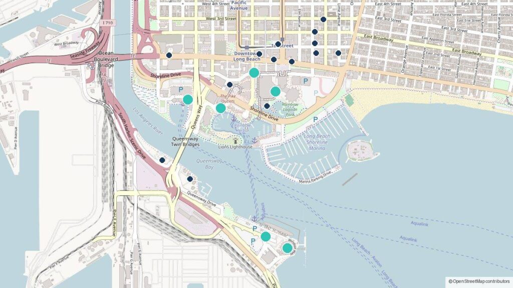
The hotels, terminals and venues of downtown Long Beach, California on one map, with the minutes on foot from each hotel to the Long Beach Cruise Terminal, the Long Beach Convention Center, the Aquarium of the Pacific, the Catalina Express landing and the Downtown Long Beach A Line station. Switch on the parking, transit and business layers for the garages and lots, the Passport stops and the city offices where permits and licenses are handled, and the two area layers for the city’s business improvement districts and its street sweeping blocks. Every pin and area links to the guide that covers it.
How the walking minutes are measured
Each hotel’s minutes come from pedestrian routing on OpenStreetMap’s map data (the Valhalla routing engine run by the OpenStreetMap community), from the hotel’s position to a sidewalk point at each destination: the cruise terminal’s entrance on Windsor Way, the Convention Center’s Ocean Boulevard front, the Aquarium’s entrance on Aquarium Way, the Catalina Express landing on Golden Shore and the A Line platform at West 1st Street. They are route minutes at a walking pace, not a promise: a lobby on the far side of a block, a closed crossing or luggage adds time. No official page in Long Beach publishes a hotel-to-terminal walking time, which is why this map measures one; the cruise terminal hotels page explains what the hotels and the tourism bureau do and do not state.
What is on the map
- Terminals and venues. The cruise terminal, the Convention Center, the Aquarium, the Catalina Express landing, the Queen Mary, the airport and the Pike, each linked to its logistics guide: Getting in and out of Long Beach is the section pillar.
- Hotels. The downtown hotels on the tourism bureau’s list, the two that state a cruise package on their own pages, and the two by the airport, each with its walking minutes. Addresses come from the cruise terminal and Convention Center hotel pages.
- Parking. The City Place, Broadway, Civic Center, Pike and Aquarium garages, the Convention Center garage, the Shoreline Village, Queen Mary and Catalina Landing lots and the airport structure, with the rates on the parking by trip page.
- Transit. The Downtown Long Beach A Line station and the four Passport stops of route 37; fares and service are on the transit page.
- Business desks. City Hall’s Permit Center and Business License Division, the Health Department’s Environmental Health bureau and the Port’s administration building, linked to the Business desk and the Property desk.
- Business districts. The city’s current merchant, property and tourism business improvement districts as shaded areas, from the city’s own layer; a business inside one pays an assessment on top of the license tax, explained on the license cost page.
- Street sweeping. Every sweeping area in the city’s layer with its days and hours, shaded; click a block to read them. The posted sign governs, and how to check before you leave the car is on the parking by trip page.
Where the positions come from
Positions are OpenStreetMap’s, looked up by address and checked on the map; the tiles are OpenStreetMap’s too. Hours, prices, shuttle routes and parking rules are never on the map itself: they live in the guides with the date each was checked, so a pin’s note tells you which guide answers the question. The business district and street sweeping areas are copies of the City of Long Beach’s open data layers on MapsLB, taken on October 2, 2026 and refreshed when the map is rebuilt; the Data desk’s methodology page quotes the terms that allow that reuse and describes the city layers behind the data pages.